
A map of Bali makes more sense once you stop thinking in kilometres and start thinking in driving times and regions. The island is small, but its roads are slow, and the landscape changes quickly from crowded southern beaches to terraced hills, volcanoes and lonely coasts. Rather than trying to see everything, most visitors pick a base or two that matches the trip they want, then take day trips out from there.
Picture the island as a handful of regions rather than a grid of roads: the busy south where you land, the cultural centre around Ubud, the volcanic north and its lakes, the quiet east, and the Nusa Islands offshore to the south-east. Work out where to stay and how far apart things really sit, then follow the links through to each area.
The south: where you land and where most people stay
The south is the flat, wide end of the island, and it holds the airport, the capital Denpasar, and the best-known beach areas. Coming out of Ngurah Rai airport you are within minutes of Kuta, a short drive from Seminyak and Canggu to the north-west, and a similar drive to Jimbaran and the Bukit Peninsula to the south.
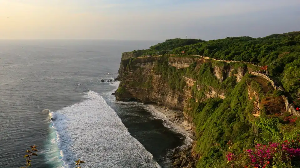
Each southern area has its own character. Kuta is the old package-holiday heart, busy and cheap. Seminyak is smarter, with boutiques and beach clubs. Canggu draws surfers and a younger, long-staying crowd. Below them all hangs the Bukit Peninsula, a raised block of limestone where Uluwatu and Jimbaran sit above cliffs and coves. Because everything is close together, the south is the easiest base for a first trip, though it is also the most built-up and the most prone to traffic.
Ubud and the cultural centre
Inland from the south, the land rises gently into the island’s cultural centre, Ubud. It is about 90 minutes by car from the airport, a little cooler than the coast, and ringed by rice terraces, river gorges, temples and craft villages. Ubud is not a beach base, which surprises some first-time visitors, but it is the best place to feel the Hindu culture that makes Bali distinct.
From Ubud you are well placed for day trips in several directions: north to the volcanoes and lakes, or back south to the beaches. Many people split their time, using Ubud for a few days of temples and terraces and the coast for a few days of sea and surf. The road between the two runs through Denpasar’s suburbs and can be slow at busy times.
The volcanic north and the lakes
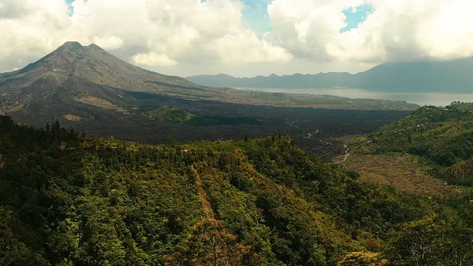
Behind Ubud the land climbs to a spine of volcanoes and crater lakes that runs across the middle and north of the island. The Kintamani area looks down into the vast caldera of Mount Batur, with its lake and its still-active cone. Further west, around Bedugul and Munduk, lie cooler lakeside country, mountain waterfalls and the temple of Ulun Danu Beratan set at the edge of a lake.
This highland belt is the wettest and greenest part of Bali, and the source of the water that irrigates the terraces below. It is a few hours’ drive from the south, so many visitors see it on a long day trip rather than staying overnight. Beyond it, the road drops to the north coast, where the sea is calm, the sand dark and volcanic, and the towns quiet compared with the south.
The quiet east and the Nusa Islands
The east of Bali is drier and less developed. Around Amed, a string of fishing villages faces a calm sea that is good for diving and snorkelling, with Mount Agung rising behind. This coast has black volcanic sand and a slow pace, and it suits travellers looking to get away from the crowds of the south.
Off the south-east corner lie the three Nusa Islands, reached by fast boat from Sanur in about 30 to 45 minutes. Nusa Penida is the largest and most rugged, with dramatic cliffs and rough roads; Nusa Lembongan and Nusa Ceningan are smaller and gentler. They feel a world apart from the mainland, though they are administratively part of Bali.